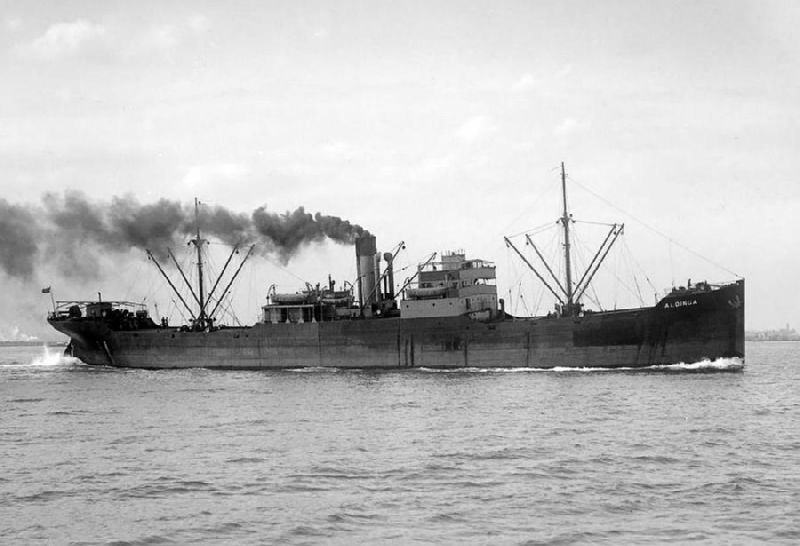
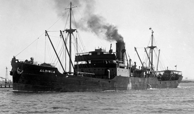
Classificazione
|
Classification
|
L.R.
n. -  100 - A -1
 |
| Bandiera |
Flag
|
Australia
- Australia |
| Armatore |
Owner |
Adelaide
Steamship Co. Ltd. - Adelaide |
| Impostazione
chiglia |
Keel
laid |
|
| Varo |
Launched |
19.02.1920 |
Consegnata
|
Delivered |
13.05.1920 |
| Cantiere
navale |
Shipyard |
Dublin
Dockyard - Dublin - Ireland |
| Costruzione
n. |
Yard
number |
100 |
| Tipo
di scafo |
Hull
type |
Scafo
singolo - single hull |
| Materiale
dello scafo |
Hull
material |
acciaio
- steel |
| Nominativo
Internazionale |
Call
Sign |
V
J B F - 


|
| I.M.O.
International Maritime Organization |
|
| M.M.S.I.
Maritime Mobile Service Identify |
|
| Compartimento
Marittimo |
Port
of Registry |
Melbourne |
| Numero
di Registro |
Official
Number |
138912 |
| Stazza
Lorda |
Gross
Tonnage |
3.078
Tons |
| Stazza
Netta |
Net
Tonnage |
1.865
Tons |
Portata
(estiva)
|
DWT
(summer) |
|
| Lunghezza
max |
L.o.a. |
|
| Lunghezza
tra le Pp |
L.
between Pp |
100,9
m |
| Larghezza
max |
Breadth
max |
14,20
m |
| Altezza
di costruzione |
Depth
|
7,0
m |
| Bordo
libero |
Freeboard |
|
| Pescaggio
max |
Draught
max |
|
Motore
principale
|
Main
engine |
1
- McKie & Baxter -steam engine triple expansion |
| Potenza
Motori |
Engine
power |
433
Hp |
Velocità
massima
|
Max
speed |
10,0
kn |
Eliche
di propulsione
|
Propellers |
1
- |
| Bunker
|
Bunker |
|
| Stive |
Holds |
4
- |
| Boccaporti |
Hatches
|
4
- |
| Volume
stive |
Cargo
capacity |
|
| Mezzi
di carico |
Cargo
gear |
10
- bighi / derricks |
| Acqua
di zavorra |
Ballast
water |
|
| Affondata |
Wrecked |
30.04.1955
|
| Inserita |
Posted |
31.01.2015
|
| Aggiornata
al |
Last
updated |
31.01.2015
|
INFORMAZIONI
STORICHE
Il 30.04.1955 a causa della
nebbia , mentre si trovava in navigaazione a sud di Cap Town affondo
in Lat. 22.30S - Long. 14.27E
Denominazioni
ex
GLENSTAL |
Bandiere |
|
|
HYSTORYCAL
INFO
The 30.4.1955 due to fog,
while he was in navigaazione south of Cap Town lunge Lat. 22.30S - Long.
14.27E
Former
names
ex
GLENSTAL
|
Former
flags |
|