 |

|
|
|
|
|
|
 |
|
Nave
da ricerca
|
| |
|
ERNEST
SHACKLETON
dal/from 2019 LAURA BASSI |
| Classificazione | Classification | D.N.V./G.L. n. - | ||||||||||||||
| Bandiera | Flag | Isole Falkland - Falkland Islands | ||||||||||||||
| Armatore | Owner | GC Rieber Shipping - U.K | ||||||||||||||
| Operatore | Manager | British Antarctic Survey | ||||||||||||||
| Impostazione chiglia | Keel laid | |||||||||||||||
| Varo | Launched | |||||||||||||||
| Consegna | Delivered | 28.09.1995 | ||||||||||||||
| Cantiere navale | Shipyard | KVAERNER FJELLSTRAND PTE. LTD. - Omastrand - Norway | ||||||||||||||
| Costruzione n. | Yard number | 267 | ||||||||||||||
| Tipo di scafo | Hull type | scafo singolo - single hull | ||||||||||||||
| Materiale dello scafo | Hull material | acciaio ordinario - ordinary steel | ||||||||||||||
| Nominativo Internazionale | Call Sign | Z
D L S 1 - |
||||||||||||||
| I.M.O. International Maritime Organization | 9114256 | |||||||||||||||
| M.M.S.I. Maritime Mobile Service Identify | ||||||||||||||||
| Compartimento Marittimo | Port of Registry | Port Stanley | ||||||||||||||
| Numero di Registro | Official Number | 732681 | ||||||||||||||
| Posizione attuale | Actual position | |||||||||||||||
| Stazza Lorda | Gross Tonnage | 4.028 Tons | ||||||||||||||
| Stazza Netta | Net Tonnage | 1.209 Tons | ||||||||||||||
| Portata (estiva) | DWT ( summer) | 1.934 Tonn | ||||||||||||||
| Lunghezza max | L.o.a. | 80,0 m | ||||||||||||||
| Lunghezza tra le Pp | L. between Pp | 72,40 m | ||||||||||||||
| Larghezza max | Breadth max | 17,0 m | ||||||||||||||
| Altezza di costruzione | Depth | 8,55 m | ||||||||||||||
| Pescaggio max | Draught max | 6,85 m | ||||||||||||||
| Bordo libero (estivo) | Summer Freeboard | 1.714,00 mm | ||||||||||||||
| Motore Principale | Main engine | 2 x 2.645 kW ( tot.5.290 kW ) | ||||||||||||||
| Potenza motori | Engine power | 2 - ULSTEIN BERGEN - NORWAY -4S 6cyl-line 320 x 360 Chp | ||||||||||||||
| Velocità max | Speed max | 13,0 kts | ||||||||||||||
| Eliche | Propellers | 1 - passo variabile / Controllable pitch | ||||||||||||||
| Bunker | Bunker | |||||||||||||||
| Acqua dolce | Fresh water | |||||||||||||||
| Capacità di carico | Cargo capacity | 3.000 m3 | ||||||||||||||
| Sistema Posizionamento Dinamico | Dinamic position | |||||||||||||||
| Mezzi di carico | Cargo gear | 2 - gru/cranes : 1 x 50 Tonn - 1 x 10 Tonn | ||||||||||||||
| Equipaggio | Crew | 22 + 50 passeggeri/passengers | ||||||||||||||
| Inserita | Posted |
18.08.2023
|
||||||||||||||
| Aggiornata al | Last updated |
18.08.2023
|
||||||||||||||
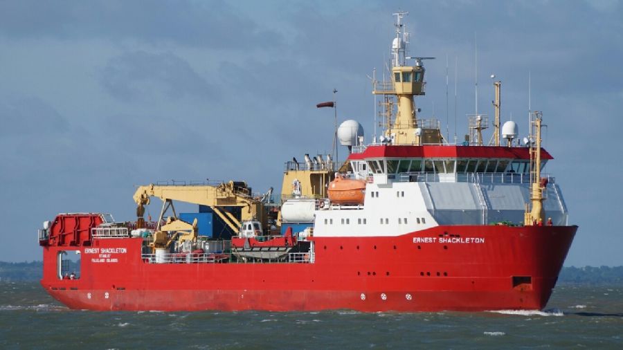
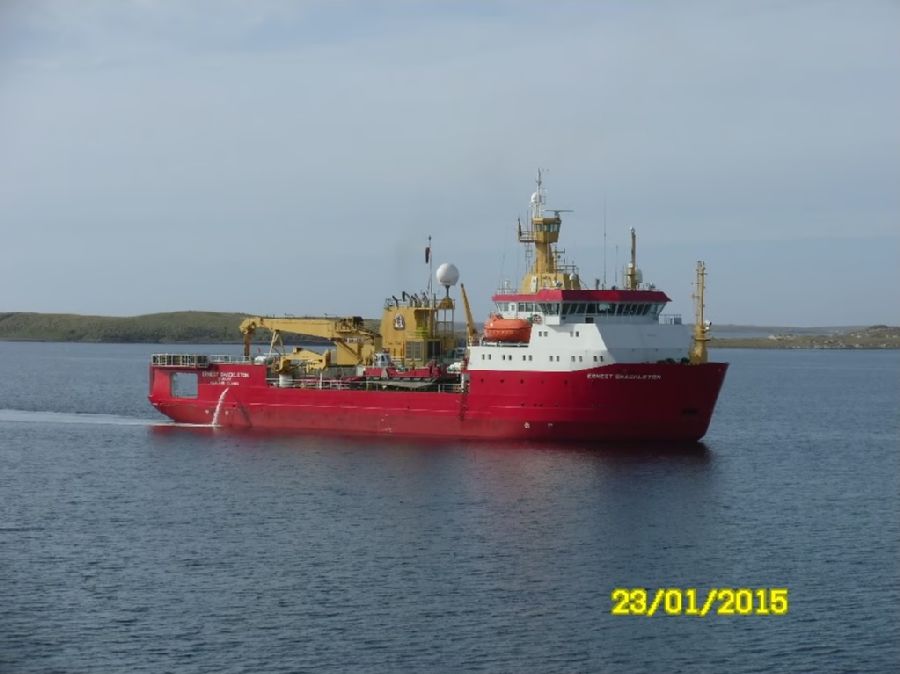
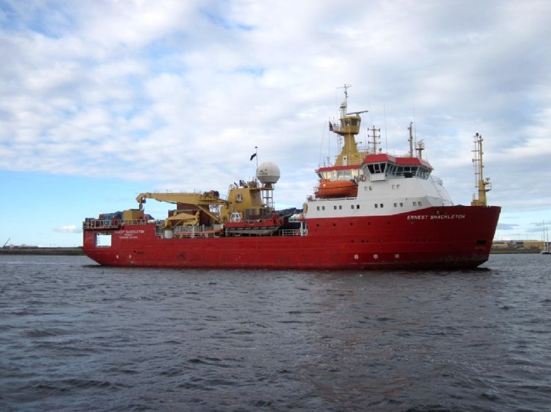
Ha svolto servizio operativo in Antartide, il British Antarctic Survey la noleggio a lungo termine nell'agosto 1999 e la rinominò RRS ERNEST SHACKLETON. Nel maggio 2019 è stata acquistata dall'Istituto Nazionale di Oceanografia e di Geofisica Sperimentale italiano grazie ad un finanziamento del MIUR per essere utilizzata come nave da ricerca e da supporto logistico in Antartide, ed è stata ribattezzata LAURA BASSI. Nel Marzo 2022 il raggruppamento temporaneo di impresa (RTI) composto dalle società: PB Tankers SPA, MAMA Shipping SARL e Monegle Shipping LTD, si sono aggiudicati il bando pluriennale per la completa gestione della nave. La MAMA Shipping SARL per la gestione dell'equipaggio ha formalizzato un contratto di service level agreement con la società monegasca Marine Partners SAM. Al momento dell'acquisto era la prima nave della ricerca oceanografica italiana con capacità di operare in mari ghiacciati, arrivando a infrangere fino a 0,5 m di spessore. La nave si divide in un'area poppiera ad uso scientifico, con 90 m² di laboratorio e una pista di atterraggio per elicotteri da 10 t (Eurocopter EC225 Superpuma); un'area cargo centrale con gru da 50 t, una gru di servizio da 10 t, 3.000 m³ di spazio nella stiva e alloggiamenti per 2 container laboratori da 20'; un'area comando e alloggi per i 22 membri dell'equipaggio e fino a 50 membri di personale scientifico, ed inoltre dotata d'infermeria, palestra, spogliatoi, lavanderia, mensa, sauna e zone ricreative. Nell'estate australe 2019/2020 ha effettuato la prima campagna antartica sotto bandiera italiana effettuando due rotazioni fra la Nuova Zelanda e la base Italiana, Stazione Mario Zucchelli. Nel corso della seconda rotazione la nave ha raggiunto il punto più meridionale mai toccato da una nave italiana (latitudine 78° 41.1006 S) a solo 1 miglio dal record mondiale. Questo record è stato battuto nel corso di un campionamento nel Mare di Ross in Antartide, effettuato per la campagna oceanografica della 35ª spedizione. Durante la 38ª Spedizione Italiana del Programma Nazionale di Ricerche in Antartide (PNRA) ha toccato il punto più a Sud mai raggiunto da una nave (latitudine di 78° 44.280' S)[3], esplorando un sito fino a oggi inesplorato del Mare di Ross.
She did operational duty in Antarctica, the British Antarctic Survey chartered her on a long-term basis in August 1999 and renamed her RRS ERNEST SHACKLETON. In May 2019 she was purchased by the Italian National Institute of Oceanography and Experimental Geophysics thanks to a grant from MIUR to be used as a research and logistic support vessel in Antarctica, and was renamed LAURA BASSI. In March 2022 the temporary consortium (RTI) made up of the companies: PB Tankers SPA, MAMA Shipping SARL and Monegle Shipping LTD, were awarded the multi-year tender for the complete management of the vessel. MAMA Shipping SARL for crew management has formalized a service level agreement with the Monegasque company Marine Partners SAM. At the time of purchase she was the first Italian oceanographic research vessel capable of operating in icy seas, breaking up to 0.5m thick. The ship is divided into an aft area for scientific use, with a 90 m² laboratory and a landing pad for 10 t helicopters (Eurocopter EC225 Superpuma); a central cargo area with a 50t crane, a 10t service crane, 3,000m³ of hold space and accommodation for 2 x 20' laboratory containers; a command area and accommodation for 22 crew members and up to 50 scientific personnel, and also equipped with an infirmary, gymnasium, changing rooms, laundry, canteen, sauna and recreation areas. In the austral summer 2019/2020 you carried out the first Antarctic campaign under the Italian flag, carrying out two rotations between New Zealand and the Italian base, Mario Zucchelli Station. During the second rotation the vessel reached the southernmost point ever touched by an Italian vessel (latitude 78° 41.1006 S) just 1 mile off the world record. This record was broken during a sampling in the Ross Sea in Antarctica, carried out for the oceanographic campaign of the 35th expedition. During the 38th Italian Expedition of the National Antarctic Research Program (PNRA) it touched the southernmost point ever reached by a ship (latitude 78° 44.280' S) [3], exploring a hitherto unexplored site in the Sea of Ross.
|
||||||||||||||||